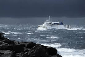
The climate changes that have been taking place in recent years and the high temperatures recorded this summer in the Atlantic could cause more storms and worsen the new hurricane season.
Experts believe that the archipelagos located in the Atlantic could be more exposed, as is the case with Meteored meteorologist Alfredo Graça, who says that within the next 7 to 10 days – between September 24 and 26 – the Azores archipelago will be potentially exposed to the approach of a tropical cyclone system: the current tropical depression Gordon and potential tropical storm or hurricane Gordon.
Meteored’s reference model anticipates more intense rainfall, potentially accompanied by electrical activity, from the current tropical depression Gordon, which will be active from September 24 until the 26th. in the Azores archipelago, especially in the Western and Central Groups.

Corvo and Flores are much more exposed.
Gordon would be coupled to another low-pressure system in more northerly latitudes on that date.
The wind, which would blow from the southwest due to Gordon, has increased in intensity, and gusts of almost 70 km/h are forecast.
Meteorologist Alfredo Graça warns that the uncertainty is very high, especially considering the length of the forecast (more than 5 days).
Although some of the models belonging to the European Center for Medium and Long-Range Forecasts (ECMWF) place Gordon somewhat far from the Portuguese Autonomous Region in its path (west of Corvo and Flores), the expert adds that other ECMWF models reveal a probability of impact of between 5 and 20% for the current tropical depression Gordon in the Azores.
A good number of the models analyzed predict the likelihood of the Western and Central Groups of the Azores being hit by the ‘remnants’ of the current tropical depression Gordon, especially the islands of Corvo and Flores.
Although the probability is low, Gordon could have developed into a tropical storm or even a category 1 hurricane by the time it reached the Azores.
The areas of the insular territorial unit potentially most affected by Gordon would be the islands of Corvo and Flores, both located in the Western Group of the Azores.

Other islands could be affected.
However, the possibility of atmospheric instability spreading to other islands, such as those in the Central Group (Faial, Pico, São Jorge, Graciosa, and Terceira), exists, and all precautions should be taken into account, warns Alfredo Graça.
If the current forecasts come true, Gordon’s trajectory would be an impressive “journey”, from its genesis around 20 ºN, to almost 40 ºN, when it passes over the Azores, he adds.
As for the ECMWF weekly average anomaly trend maps, most of those analyzed seem to point to a scenario that favors adverse weather conditions in the Azores during the week of September 23 to 30 since there are positive anomalies for precipitation, temperature, and average pressure at sea level in this archipelago, concludes Alfredo Graça.

Above-normal seawater in the Azores boosts storms.
Ricardo Deus, Head of the Climate and Climate Change Division at the Portuguese Institute for the Sea and Atmosphere (IPMA), also told Expresso last week that “with the average sea surface temperature 3-4 degrees above average in the Azores, it is possible that more phenomena such as tropical storms will be potentiated”.
According to the IPMA, tropical storm Gordon, named on Friday, September 13, when it was located about 1600 km west-northwest of the Cape Verde Islands, is the 7th tropical cyclone of the 2024 season in the North Atlantic and Gulf of Mexico region. At this time of year, the average number of tropical cyclones in this region is 8, so the current number is slightly below average.

7 tropical cyclones so far
The 7 tropical cyclones that have formed in 2024 so far have reached at least the tropical storm class, with 4 being hurricanes. The data indicate a greater intensity in relation to the phase of the season in which they appear.
At the end of June and beginning of July, Hurricane Beryl (the 2nd tropical cyclone of the season) hit the Caribbean and the Gulf of Mexico.
Hurricane Beryl reached category 3 on June 30, affected the Windward Islands as category 4 on July 1 (image) and Jamaica on July 3, and was temporarily category 5 during this period. Hurricane Beryl also hit the US state of Texas on July 8 with a category 1.
Thus, Hurricane Beryl made landfall around 40 days before the date on which, on average, the first hurricane makes landfall in these basins – August 11—and reached category 3 or higher around 2 months before the date on which, on average, tropical cyclones of this intensity usually make landfall—September 1.
The sixth tropical cyclone of the season, meanwhile, was Hurricane #Francine. It hit the US states of Louisiana and Mississippi on September 11 and 12 as a category 2, making it the fourth hurricane of the season, something that, on average, doesn’t occur until September 16.
Hurricane #Ernesto, the 3rd of the season, reached category 1 on August 14, which, on average, only occurs on September 7, having temporarily reached category 2 and affecting Bermuda with category 1 on August 16.

in Diário dos Açores – Osvaldo Cabral, director
Translated to English as a community outreach program from the Portuguese Beyond Borders Institute (PBBI) and the Modern and Classical Languages and Literatures Department (MCLL) as part of Bruma Publication and ADMA (Azores-Diaspora Media Alliance) at California State University, Fresno, PBBI thanks Luso Financial for sponsoring NOVIDADES.


