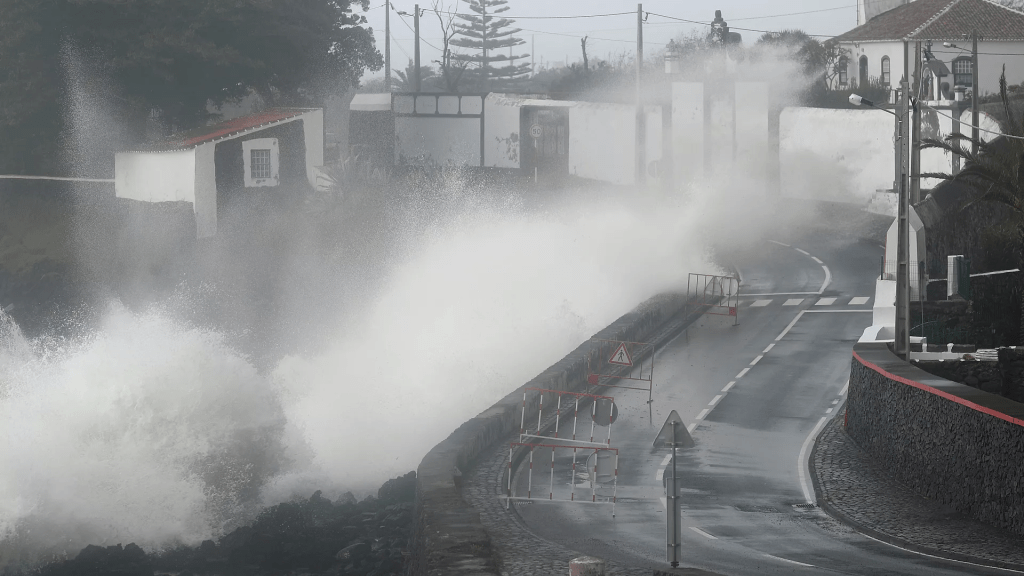
The Portuguese Sea and Atmosphere Institute (IPMA) warned today that Storm Kirk will pass north of the Azores archipelago on Tuesday and will cause heavy rainfall, increased wind intensity, and sea turbulence.
According to a statement from IPMA’s Azores office, the storm “has completed its transition to an extratropical cyclone” and, at 21:00 local time (22:00 in Lisbon), its center was around 500 km northwest of the Azores (Flores island) and moving east.
“The storm will pass to the north of the archipelago during tomorrow (the 8th), conditioning the weather on all the islands, causing precipitation, sometimes heavy, which may be accompanied by thunderstorms, an increase in the intensity of the wind and sea turbulence,” he said.
Wind gusts of “up to 115 km/h [kilometers per hour] and waves that could reach 11 meters of significant height (19 meters of maximum height) are forecast for the Western group” (Flores and Corvo).
In the Central group (Faial, Pico, Terceira, São Jorge and Graciosa) “gusts of up to 90 km/h are expected and waves that could reach eight meters of significant height (15 meters of maximum height)”.
For the eastern group (São Miguel and Santa Maria), the IPMA predicts waves that “could reach six meters in significant height (12 meters in maximum height)”.
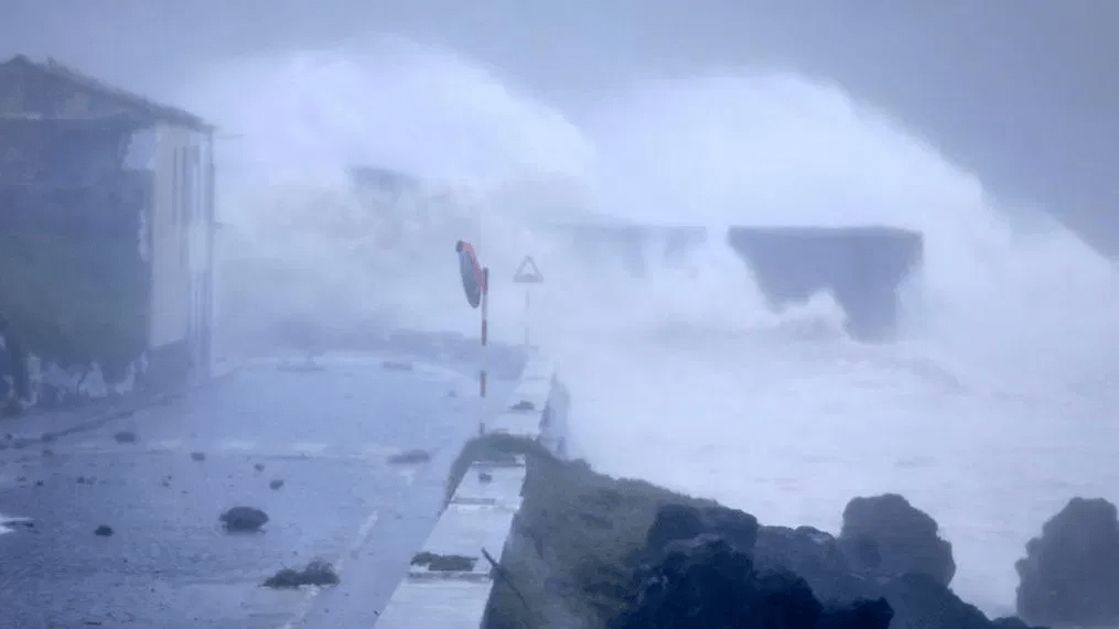
Due to Storm Kirk’s passage through the Azores archipelago, the IPMA has issued a red warning for Tuesday for the islands of the Western group due to the waves.
Orange and yellow warnings have also been issued for the Western, Central, and Eastern islands due to sea turbulence, wind, and sometimes heavy rain.
According to a statement issued by the IPMA, the red alert for the islands of Corvo and Flores is valid between 00:00 local time and 09:00 on Tuesday due to sea agitation due to forecasts of westerly waves, which could reach a maximum height of 19 meters.
Due to sea turbulence, these two islands are also under an orange warning until 00:00 on Tuesday and from 09:00 to 12:00.
Flores and Corvo will also be under an orange warning due to wind between 00:00 and 09:00 on Tuesday.
The IPMA has also issued a yellow warning for those islands due to sea turbulence (between 12:00 and 15:00 on Tuesday) and wind (until 00:00 on Tuesday and from 09:00 to 12:00 on Tuesday).
For the Central Azorean group, the orange warning is in force from 06:00 to 12:00 on Tuesday, the yellow warning from 00:00 to 06:00 and from 12:00 to 18:00.
The islands of Faial, Pico, Terceira, São Jorge, and Graciosa are also under a yellow warning for “sometimes heavy precipitation, possibly accompanied by thunderstorms” until 06:00 on Tuesday and, due to wind, between 00:00 and 18:00.
Due to sea turbulence, the yellow warning for the Eastern group is in force from 09:00 to 18:00 on Tuesday.
In Jornal das 9
Translated to English as a community outreach program from the Portuguese Beyond Borders Institute (PBBI) and the Modern and Classical Languages and Literatures Department (MCLL) as part of Bruma Publication and ADMA (Azores-Diaspora Media Alliance) at California State University, Fresno, PBBI thanks Luso Financial for sponsoring NOVIDADES.