IPMA Releases 2025 Annual Climate Bulletin
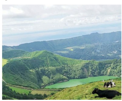
The Portuguese Institute for Sea and Atmosphere (IPMA) this week released its 2025 Annual Climate Bulletin for the Autonomous Region of the Azores, highlighting continued warming across the archipelago — most notably in ocean waters surrounding São Miguel and Santa Maria.
Sea surface temperatures near those two islands registered an anomaly of +0.7°C, the second-highest value recorded since 1941. The figure is part of a striking nine-year stretch of consecutive positive deviations, a period that includes the four warmest years in the historical record: 2024, 2025, 2023, and 2018.
Across the archipelago as a whole, average sea surface temperature showed an anomaly of +0.5 ± 0.5°C. Seasonally, winter and summer recorded deviations between +0.5 and +1°C, while spring ranged from 0 to +0.5°C and autumn held steady at +0.5 ± 0.5°C.
Severe Weather Marks the Year
According to IPMA, 2025 was also shaped by multiple severe weather episodes linked to low-pressure systems embedded in the disturbed westerly flow and the passage of a tropical cyclone.
From January through March, persistent westerly winds allowed the Polar Front to sweep repeatedly across the region.
Between January 17 and 21, Storm Garoe battered the Central and Eastern Groups, producing wind gusts of 122 km/h on Faial on January 20. That same day, São Miguel’s Nordeste recorded 50.1 mm of rainfall.
March brought another series of storms — Konrad, Laurence, and Martinho — all passing north of the archipelago and triggering strong winds, heavy rainfall, and rough seas.
- Konrad (March 10–14) produced gusts of 134 km/h on Faial and more than 47 mm of rain on Corvo.
- Laurence (March 14–18) brought gusts of 108 km/h and 58 mm of rainfall to São Miguel.
- Martinho (March 14–22) generated gusts of 100 km/h and moderate to heavy precipitation on São Miguel.
In September, Post-Tropical Cyclone Gabrielle passed between September 25 and 26, severely affecting the Central and Eastern Groups. September 26 proved particularly intense, with gusts reaching 154 km/h on Faial and rainfall exceeding 60 mm on Graciosa.
Air Temperatures Also Climb
Air temperatures reflected the broader warming trend. The region’s annual average anomaly reached +0.5 ± 0.5°C.
Winter posted the strongest deviation (+0.5 to +1°C), followed by spring (0 to +0.5°C). Summer and autumn maintained steady anomalies of +0.5 ± 0.5°C.
In Ponta Delgada, the average air temperature measured 2 meters above ground showed a positive deviation of +0.4°C, making 2025 the sixth-warmest anomaly recorded there since 1941. The data reinforce the ongoing nine-year streak of above-average temperatures, including the city’s three record-breaking years: 2024, 2023, and 2021.
Across the monitoring network, average daily air temperatures ranged from 17.4°C in Nordeste (São Miguel) to 18.7°C at the Horta Observatory on Faial.
The year’s coldest reading was 5.2°C, recorded on Flores Island on February 27. The highest temperature recorded was 31.2°C at the Horta Observatory on August 6.
Solar Radiation and Atmospheric Clarity
Annual global solar radiation anomalies ranged from -0.15 MJ/m² in the Eastern and Central Groups to +0.35 MJ/m² in the Western Group. These values represent variations in accumulated solar energy per square meter.
Meanwhile, the annual atmospheric clarity index — measuring the ratio between surface-observed radiation and expected radiation at the top of the atmosphere — ranged from a high of 52% at Graciosa to a low of 47% in Angra do Heroísmo.
Flores Records Highest Rainfall Totals
Precipitation levels also varied across the region. The average daily rainfall anomaly stood at +0.5 ± 0.5 mm per day.
Winter saw increases between 0 and +1 mm/day in the Eastern Group and between +1 and +3 mm/day in the Western and Central Groups. Spring and autumn showed more moderate increases, while summer recorded a slight negative deviation between -1 and 0 mm/day.
Flores registered the highest annual rainfall total at 1,835.4 mm. In contrast, Ponta Delgada recorded the lowest total, with 833.2 mm.
The single highest daily rainfall event occurred February 20 in Nordeste (São Miguel), where 92.8 mm was recorded.
Atmospheric Pressure Patterns
Throughout 2025, the North Atlantic Subtropical High was generally centered southwest of the Azores, with its major axis oriented southwest-to-northeast and extending toward the Iberian Peninsula and mainland Europe.
Across the archipelago, pressure anomalies ranged from 0 to -1 hectopascals (hPa). Winter saw the most pronounced negative deviations (-3 to -1 hPa), followed by spring (-1 to 0 hPa). In contrast, summer posted positive anomalies between +1 and +2 hPa, while autumn ranged from 0 to +1 hPa.
(One hectopascal equals 100 pascals and is the standard unit used in meteorology to measure atmospheric pressure.)
José Henrique Andrade is a journalist for Correio dos Açores-Natalino Viveiros, director
The 2025 climate data confirm what scientists have increasingly warned: the Azores remain firmly within a sustained warming trend, with ocean temperatures in the Eastern Group reaching their second-highest level in more than eight decades
Translated into English as a community outreach program by the Portuguese Beyond Borders Institute (PBBI) and the Modern and Classical Languages and Literatures Department (MCLL), in collaboration with Bruma Publication and ADMA (Azores-Diaspora Media Alliance) at California State University, Fresno. PBBI thanks Luso Financial for sponsoring NOVIDADES.